
Thank you for supporting this site ❤️
Make a donation
Make a donation
Gear up for your next adventure:
As an Amazon Associate, this site earns from qualifying purchases at no extra cost to you.
Chiriboga topographic map
Click on the map to display elevation.
Thank you for supporting this site ❤️
Make a donation
Make a donation
Gear up for your next adventure:
As an Amazon Associate, this site earns from qualifying purchases at no extra cost to you.
About this map
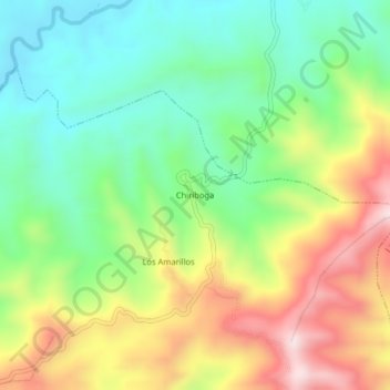
Name: Chiriboga topographic map, elevation, terrain.
Location: Chiriboga, La Libertad, Las Lajas, El Oro, Ecuador (-3.84794 -80.10201 -3.80794 -80.06201)
Average elevation: 1,870 ft
Minimum elevation: 1,204 ft
Maximum elevation: 2,881 ft
Thank you for supporting this site ❤️
Make a donation
Make a donation
Gear up for your next adventure:
As an Amazon Associate, this site earns from qualifying purchases at no extra cost to you.