
Make a donation
Gear up for your next adventure:
As an Amazon Associate, this site earns from qualifying purchases at no extra cost to you.
Hunau topographic map
Click on the map to display elevation.
Make a donation
Gear up for your next adventure:
As an Amazon Associate, this site earns from qualifying purchases at no extra cost to you.
Hunau
Die Hunau erhebt sich zwischen Siedlinghausen (zu Winterberg) im Nordosten und Bad Fredeburg (zu Schmallenberg) im Südwesten auf etwa 14 km Länge. Sie liegt größtenteils auf dem Stadtgebiet Schmallenbergs, nur ihre Ostausläufer zählen zur Stadt Winterberg. Mit dem Hauptteil des Rothaargebirges hängt sie über eine abseits von Straßen im Wald auf 679,5 m Höhe befindliche Scharte zusammen, die 2,4 km nordwestlich von Altastenberg nahe dem Großen Bildchen liegt.
Make a donation
Gear up for your next adventure:
As an Amazon Associate, this site earns from qualifying purchases at no extra cost to you.
About this map
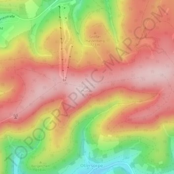
Name: Hunau topographic map, elevation, terrain.
Average elevation: 2,293 ft
Minimum elevation: 1,706 ft
Maximum elevation: 2,680 ft
Make a donation
Gear up for your next adventure:
As an Amazon Associate, this site earns from qualifying purchases at no extra cost to you.
Other topographic maps
Click on a map to view its topography, its elevation and its terrain.
Esenbeck
Deutschland > Nordrhein-Westfalen > Hochsauerlandkreis > Schmallenberg > Obersorpe
Average elevation: 2,254 ft