
Thank you for supporting this site ❤️
Make a donation
Make a donation
Gear up for your next adventure:
As an Amazon Associate, this site earns from qualifying purchases at no extra cost to you.
Boveresse topographic map
Click on the map to display elevation.
Thank you for supporting this site ❤️
Make a donation
Make a donation
Gear up for your next adventure:
As an Amazon Associate, this site earns from qualifying purchases at no extra cost to you.
About this map
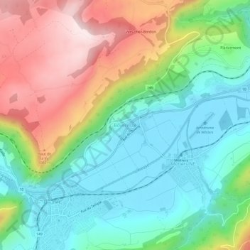
Name: Boveresse topographic map, elevation, terrain.
Location: Boveresse, Val-de-Travers, Neuchâtel, 2113, Suisse (46.89662 6.57720 46.93662 6.61720)
Average elevation: 2,963 ft
Minimum elevation: 2,392 ft
Maximum elevation: 3,967 ft
Thank you for supporting this site ❤️
Make a donation
Make a donation
Gear up for your next adventure:
As an Amazon Associate, this site earns from qualifying purchases at no extra cost to you.