
Thank you for supporting this site ❤️
Make a donation
Make a donation
Gear up for your next adventure:
As an Amazon Associate, this site earns from qualifying purchases at no extra cost to you.
Jerash Sub-District topographic map
Click on the map to display elevation.
Thank you for supporting this site ❤️
Make a donation
Make a donation
Gear up for your next adventure:
As an Amazon Associate, this site earns from qualifying purchases at no extra cost to you.
About this map
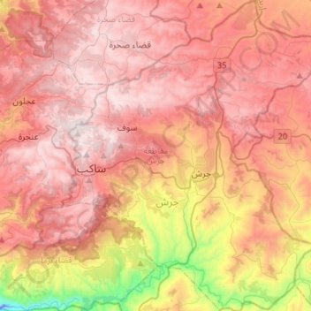
Name: Jerash Sub-District topographic map, elevation, terrain.
Location: Jerash Sub-District, Qasabah Jerash, Jarash, Jordan (32.18247 35.78312 32.40361 36.00062)
Average elevation: 2,546 ft
Minimum elevation: -89 ft
Maximum elevation: 4,081 ft
Thank you for supporting this site ❤️
Make a donation
Make a donation
Gear up for your next adventure:
As an Amazon Associate, this site earns from qualifying purchases at no extra cost to you.
Other topographic maps
Click on a map to view its topography, its elevation and its terrain.