
Thank you for supporting this site ❤️
Make a donation
Make a donation
Gear up for your next adventure:
As an Amazon Associate, this site earns from qualifying purchases at no extra cost to you.
Raquina topographic map
Click on the map to display elevation.
Thank you for supporting this site ❤️
Make a donation
Make a donation
Gear up for your next adventure:
As an Amazon Associate, this site earns from qualifying purchases at no extra cost to you.
About this map
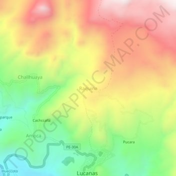
Name: Raquina topographic map, elevation, terrain.
Location: Raquina, Lucanas, Provincia de Lucanas, Ayacucho, Perú (-14.62298 -74.25319 -14.58298 -74.21319)
Average elevation: 11,644 ft
Minimum elevation: 10,240 ft
Maximum elevation: 13,074 ft
Thank you for supporting this site ❤️
Make a donation
Make a donation
Gear up for your next adventure:
As an Amazon Associate, this site earns from qualifying purchases at no extra cost to you.