
Thank you for supporting this site ❤️
Make a donation
Make a donation
Gear up for your next adventure:
As an Amazon Associate, this site earns from qualifying purchases at no extra cost to you.
Carriazo topographic map
Click on the map to display elevation.
Thank you for supporting this site ❤️
Make a donation
Make a donation
Gear up for your next adventure:
As an Amazon Associate, this site earns from qualifying purchases at no extra cost to you.
About this map
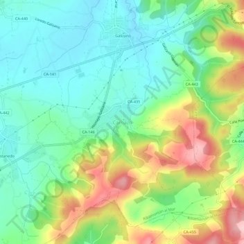
Name: Carriazo topographic map, elevation, terrain.
Location: Carriazo, Ribamontán al Mar, Cantabria, 39150, Spain (43.43406 -3.69135 43.47406 -3.65135)
Average elevation: 226 ft
Minimum elevation: 13 ft
Maximum elevation: 630 ft
Thank you for supporting this site ❤️
Make a donation
Make a donation
Gear up for your next adventure:
As an Amazon Associate, this site earns from qualifying purchases at no extra cost to you.