Geolocate

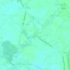
San Sebastian topographic map

Click on the map to display elevation.

About this map

Name: San Sebastian topographic map, elevation, terrain.

Location: San Sebastian, San Nicolas, San Luis, Pampanga, Central Luzon, Philippines (15.04161 120.78318 15.05468 120.79923)

Average elevation: 20 ft

Minimum elevation: 10 ft

Maximum elevation: 30 ft

Other topographic maps

Click on a map to view its topography, its elevation and its terrain.

Bambang Creek

Philippines > Pampanga > San Luis

Average elevation: 16 ft

Purok 2

Philippines > Pampanga > San Luis > Santa Monica

Average elevation: 20 ft

San Sebastian

Philippines > Pampanga > San Luis

Average elevation: 20 ft

Purok 5

Philippines > Pampanga > San Luis > San Carlos

Average elevation: 16 ft

Gear up for your next adventure:

🚗GPS Dash Cams - Record your scenic drives through mountain passes and canyons
🗺️NatGeo Topo Maps - High-quality waterproof printed topographic maps of US Parks
⛺Backpacking Tents - Weight-optimized shelters for multi-day topographic surveys
📦Dry Bags Set - Waterproof storage for electronics and clothes
🎁Geography Themed Gifts - Unique gift ideas for map lovers and geography enthusiasts

As an Amazon Associate, this site earns from qualifying purchases at no extra cost to you.