
Miltenberg topographic map
Click on the map to display elevation.
About this map
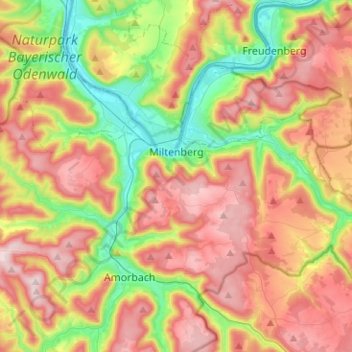
Name: Miltenberg topographic map, elevation, terrain.
Location: Miltenberg, Landkreis Miltenberg, Bavaria, 63897, Germany (49.65392 9.12120 49.72686 9.37267)
Average elevation: 1,017 ft
Minimum elevation: 390 ft
Maximum elevation: 1,683 ft
Other topographic maps
Click on a map to view its topography, its elevation and its terrain.
Miltenberg
Germany > Bavaria > Landkreis Miltenberg > Miltenberg > Miltenberg
Average elevation: 915 ft