
Thank you for supporting this site ❤️
Make a donation
Make a donation
Gear up for your next adventure:
As an Amazon Associate, this site earns from qualifying purchases at no extra cost to you.
Sugarloaf topographic map
Click on the map to display elevation.
Thank you for supporting this site ❤️
Make a donation
Make a donation
Gear up for your next adventure:
As an Amazon Associate, this site earns from qualifying purchases at no extra cost to you.
About this map
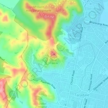
Name: Sugarloaf topographic map, elevation, terrain.
Location: Sugarloaf, Napier, Hawke's Bay, 4112, New Zealand (-39.52332 176.83934 -39.52322 176.83944)
Average elevation: 131 ft
Minimum elevation: 7 ft
Maximum elevation: 417 ft
Thank you for supporting this site ❤️
Make a donation
Make a donation
Gear up for your next adventure:
As an Amazon Associate, this site earns from qualifying purchases at no extra cost to you.