
Thank you for supporting this site ❤️
Make a donation
Make a donation
Gear up for your next adventure:
As an Amazon Associate, this site earns from qualifying purchases at no extra cost to you.
Trevejo topographic map
Click on the map to display elevation.
Thank you for supporting this site ❤️
Make a donation
Make a donation
Gear up for your next adventure:
As an Amazon Associate, this site earns from qualifying purchases at no extra cost to you.
About this map
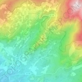
Name: Trevejo topographic map, elevation, terrain.
Location: Trevejo, Villamiel, Cáceres, Extremadura, 10893, España (40.15362 -6.79876 40.19362 -6.75876)
Average elevation: 2,208 ft
Minimum elevation: 1,486 ft
Maximum elevation: 3,465 ft
Thank you for supporting this site ❤️
Make a donation
Make a donation
Gear up for your next adventure:
As an Amazon Associate, this site earns from qualifying purchases at no extra cost to you.