
Davutlar topographic map
Interactive map
Click on the map to display elevation.
About this map
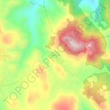
Name: Davutlar topographic map, elevation, terrain.
Location: Davutlar, Bigadiç, Balıkesir, Marmara Region, Turkey (39.47165 28.30150 39.51165 28.34150)
Average elevation: 2,113 ft
Minimum elevation: 1,283 ft
Maximum elevation: 2,999 ft
Other topographic maps
Click on a map to view its topography, its elevation and its terrain.