Geolocate

Dambulla topographic map

Click on the map to display elevation.

About this map

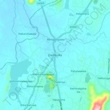
Name: Dambulla topographic map, elevation, terrain.

Location: Dambulla, Matale District, Central Province, 21000, Sri Lanka (7.83420 80.61109 7.91420 80.69109)

Average elevation: 568 ft

Minimum elevation: 472 ft

Maximum elevation: 1,755 ft

Other topographic maps

Click on a map to view its topography, its elevation and its terrain.

Upper Kotmale Dam

Sri Lanka > Central Province > Talawakele > Holyrood

Average elevation: 4,098 ft

Matale District

Sri Lanka > Central Province

Average elevation: 886 ft

Nuwara Eliya District

Sri Lanka > Central Province

Average elevation: 3,586 ft

Pitawala Pathana

Sri Lanka > Central Province

Average elevation: 2,421 ft

Canyon Dam

Sri Lanka > Central Province > Hapugastenne

Average elevation: 3,615 ft

Sigiriya

Sri Lanka > Central Province

Average elevation: 666 ft

Gear up for your next adventure:

🗻Climbing Gear Basics - Essential gear for beginner climbers
🛰️Satellite Messengers - Emergency SOS and two-way messaging for off-grid adventures
🎁Geography Themed Gifts - Unique gift ideas for map lovers and geography enthusiasts
🛶Inflatable Kayak - Portable kayak for rivers, lakes, and expeditions
📖Nature Tracking Books - Learn to track wildlife and terrain

As an Amazon Associate, this site earns from qualifying purchases at no extra cost to you.