
Barrhead topographic map
Click on the map to display elevation.
About this map
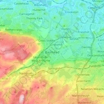
Name: Barrhead topographic map, elevation, terrain.
Location: Barrhead, East Renfrewshire, Scotland, G78 1SD, United Kingdom (55.76110 -4.42998 55.84110 -4.34998)
Average elevation: 305 ft
Minimum elevation: 23 ft
Maximum elevation: 843 ft
Other topographic maps
Click on a map to view its topography, its elevation and its terrain.
Rouken Glen Park
United Kingdom > Scotland > East Renfrewshire > Thornliebank
Average elevation: 213 ft
Dams to Darnley Country Park
United Kingdom > Scotland > East Renfrewshire > Barrhead
Average elevation: 253 ft