Geolocate

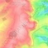
Mehring topographic map

Click on the map to display elevation.

About this map

Name: Mehring topographic map, elevation, terrain.

Location: Mehring, Schweich an der Römischen Weinstraße, Landkreis Trier-Saarburg, Rijnland-Palts, 54346, Duitsland (49.74700 6.78242 49.83804 6.87372)

Average elevation: 935 ft

Minimum elevation: 374 ft

Maximum elevation: 1,621 ft

Other topographic maps

Click on a map to view its topography, its elevation and its terrain.
Gear up for your next adventure:

🎒Waterproof Dry Bags - Keep your electronics and maps dry inside your pack
🎒Hydration Pack - Hands‑free water reservoir for long hikes
🔊Portable Camp Speaker - Music and alerts at camp
🌡️Portable Weather Meter - Track weather conditions on the trail
🦺Reflective Outdoor Gear - Safety gear for low‑light conditions

As an Amazon Associate, this site earns from qualifying purchases at no extra cost to you.