
Thank you for supporting this site ❤️
Make a donation
Make a donation
Gear up for your next adventure:
As an Amazon Associate, this site earns from qualifying purchases at no extra cost to you.
Valsequillo topographic map
Click on the map to display elevation.
Thank you for supporting this site ❤️
Make a donation
Make a donation
Gear up for your next adventure:
As an Amazon Associate, this site earns from qualifying purchases at no extra cost to you.
About this map
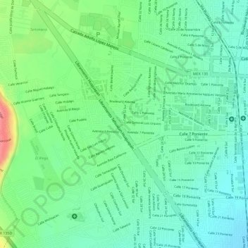
Name: Valsequillo topographic map, elevation, terrain.
Location: Valsequillo, Tehuacán, Puebla, 75700, México (18.45555 -97.41653 18.46047 -97.41301)
Average elevation: 5,433 ft
Minimum elevation: 5,335 ft
Maximum elevation: 5,627 ft
Thank you for supporting this site ❤️
Make a donation
Make a donation
Gear up for your next adventure:
As an Amazon Associate, this site earns from qualifying purchases at no extra cost to you.