
Make a donation
Gear up for your next adventure:
As an Amazon Associate, this site earns from qualifying purchases at no extra cost to you.
Rock Creek topographic map
Click on the map to display elevation.
Make a donation
Gear up for your next adventure:
As an Amazon Associate, this site earns from qualifying purchases at no extra cost to you.
About this map
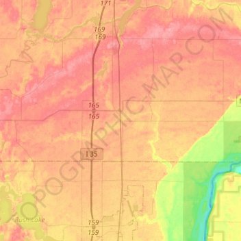
Name: Rock Creek topographic map, elevation, terrain.
Location: Rock Creek, Pine County, Minnesota, United States (45.73002 -93.02198 45.78855 -92.77700)
Average elevation: 935 ft
Minimum elevation: 761 ft
Maximum elevation: 1,030 ft
Pine County trails, hiking, mountain biking, running and outdoor activities
Make a donation
Gear up for your next adventure:
As an Amazon Associate, this site earns from qualifying purchases at no extra cost to you.
Other topographic maps
Click on a map to view its topography, its elevation and its terrain.
Big Pine Lake
United States > Minnesota > Pine County > Pine Lake Township
Average elevation: 1,112 ft