Geolocate

Urdaneta topographic map

Click on the map to display elevation.

About this map

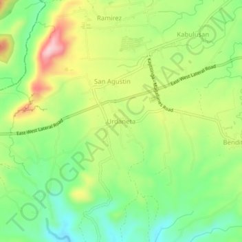
Name: Urdaneta topographic map, elevation, terrain.

Location: Urdaneta, Magallanes, Cavite, Calabarzon, 4113, Philippines (14.14481 120.71226 14.18481 120.75226)

Average elevation: 581 ft

Minimum elevation: 282 ft

Maximum elevation: 1,001 ft

Other topographic maps

Click on a map to view its topography, its elevation and its terrain.

Buhay Forest

Philippines > Cavite > Magallanes > Ramirez

Average elevation: 630 ft

Gear up for your next adventure:

🛰️Satellite Messengers - Emergency SOS and two-way messaging for off-grid adventures
🧣Hiking Neck Gaiter - Multi‑use neck protection for outdoor weather
Backpacking Tents - Weight-optimized shelters for multi-day topographic surveys
🧭GPS Watch Accessories - Bands and chargers for GPS watches
👟Men's Trail Runners - Lightweight footwear for fast-paced exploration and light hiking

As an Amazon Associate, this site earns from qualifying purchases at no extra cost to you.