
Buch topographic map
Click on the map to display elevation.
About this map
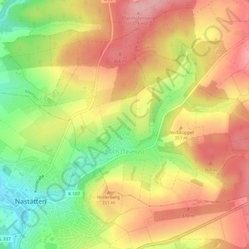
Name: Buch topographic map, elevation, terrain.
Location: Buch, Nastätten, Rhein-Lahn-Kreis, Rhineland-Palatinate, Germany (50.19850 7.85953 50.21818 7.90660)
Average elevation: 1,079 ft
Minimum elevation: 810 ft
Maximum elevation: 1,289 ft
Other topographic maps
Click on a map to view its topography, its elevation and its terrain.
Burg Hohlenfels
Germany > Rhineland-Palatinate > Rhein-Lahn-Kreis > Mudershausen
Average elevation: 925 ft