
Thank you for supporting this site ❤️
Make a donation
Make a donation
Gear up for your next adventure:
As an Amazon Associate, this site earns from qualifying purchases at no extra cost to you.
Njewa topographic map
Click on the map to display elevation.
Thank you for supporting this site ❤️
Make a donation
Make a donation
Gear up for your next adventure:
As an Amazon Associate, this site earns from qualifying purchases at no extra cost to you.
About this map
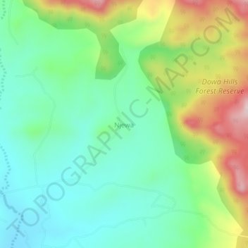
Name: Njewa topographic map, elevation, terrain.
Location: Njewa, Dowa, Central Region, Malawi, Malawi (-13.73447 33.87522 -13.69447 33.91522)
Average elevation: 4,262 ft
Minimum elevation: 3,868 ft
Maximum elevation: 5,069 ft
Thank you for supporting this site ❤️
Make a donation
Make a donation
Gear up for your next adventure:
As an Amazon Associate, this site earns from qualifying purchases at no extra cost to you.