
Caulfield topographic map
Click on the map to display elevation.
About this map
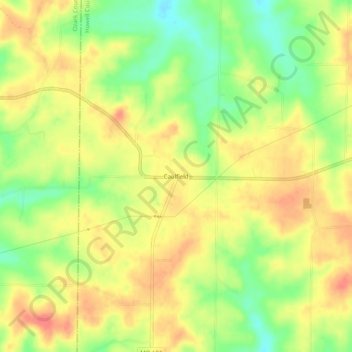
Name: Caulfield topographic map, elevation, terrain.
Location: Caulfield, Howell County, Missouri, United States (36.59451 -92.12488 36.63451 -92.08488)
Average elevation: 1,014 ft
Minimum elevation: 906 ft
Maximum elevation: 1,093 ft
Howell County trails, hiking, mountain biking, running and outdoor activities
Other topographic maps
Click on a map to view its topography, its elevation and its terrain.