Geolocate

Schalterbach topographic map

Interactive map

Click on the map to display elevation.

About this map

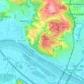
Name: Schalterbach topographic map, elevation, terrain.

Location: Schalterbach, Deggendorf, Landkreis Deggendorf, Bayern, 94526, Deutschland (48.82488 12.90828 48.86488 12.94828)

Average elevation: 1,109 ft

Minimum elevation: 1,017 ft

Maximum elevation: 1,404 ft

Other topographic maps

Click on a map to view its topography, its elevation and its terrain.

Großwalding

Deutschland > Bayern > Landkreis Deggendorf > Deggendorf > Kleinfilling

Großwalding, Kleinfilling, Deggendorf, Landkreis Deggendorf, Bayern, 94469, Deutschland

Average elevation: 1,378 ft

Mietzing

Deutschland > Bayern > Landkreis Deggendorf > Deggendorf

Mietzing, Deggendorf, Landkreis Deggendorf, Bayern, 94469, Deutschland

Average elevation: 1,434 ft

Scheidham

Deutschland > Bayern > Landkreis Deggendorf > Deggendorf > Reinprechting

Scheidham, Reinprechting, Deggendorf, Landkreis Deggendorf, Bayern, 94469, Deutschland

Average elevation: 1,362 ft

Reinprechting

Deutschland > Bayern > Landkreis Deggendorf > Deggendorf

Reinprechting, Deggendorf, Landkreis Deggendorf, Bayern, 94469, Deutschland

Average elevation: 1,299 ft