
Thank you for supporting this site ❤️
Make a donation
Make a donation
Gear up for your next adventure:
As an Amazon Associate, this site earns from qualifying purchases at no extra cost to you.
Bhandro topographic map
Click on the map to display elevation.
Thank you for supporting this site ❤️
Make a donation
Make a donation
Gear up for your next adventure:
As an Amazon Associate, this site earns from qualifying purchases at no extra cost to you.
About this map
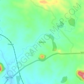
Name: Bhandro topographic map, elevation, terrain.
Location: Bhandro, Dumri, Giridih District, Jharkhand, 825167, India (24.00265 86.02054 24.04265 86.06054)
Average elevation: 1,027 ft
Minimum elevation: 899 ft
Maximum elevation: 1,388 ft
Thank you for supporting this site ❤️
Make a donation
Make a donation
Gear up for your next adventure:
As an Amazon Associate, this site earns from qualifying purchases at no extra cost to you.