
Mzingwane topographic map
Interactive map
Click on the map to display elevation.
About this map
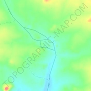
Name: Mzingwane topographic map, elevation, terrain.
Location: Mzingwane, Gwanda, Matabeleland South, Zimbabwe (-21.14293 29.36530 -21.13976 29.37008)
Average elevation: 2,694 ft
Minimum elevation: 2,605 ft
Maximum elevation: 2,822 ft
Other topographic maps
Click on a map to view its topography, its elevation and its terrain.
Upper Ncema Dam
Upper Ncema Dam, Umzingwane, Matabeleland South, Zimbabwe
Average elevation: 3,786 ft
Matobo National Park
Matobo National Park, Matobo, Matabeleland South, Zimbabwe
Average elevation: 4,367 ft
Limpopo River
Limpopo River, Beitbridge, Matabeleland South, Zimbabwe
Average elevation: 2,346 ft