

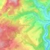
Strohn topographic map
Click on the map to display elevation.
About this map

Name: Strohn topographic map, elevation, terrain.
Location: Strohn, Daun, Landkreis Vulkaneifel, Rijnland-Palts, Duitsland (50.09135 6.89808 50.12607 6.95386)
Average elevation: 1,345 ft
Minimum elevation: 1,070 ft
Maximum elevation: 1,526 ft
Other topographic maps
Click on a map to view its topography, its elevation and its terrain.
Hinterhausen
Duitsland > Rijnland-Palts > Landkreis Vulkaneifel > Gerolstein
Average elevation: 1,493 ft


Wirfttal bei Stadtkyll
Duitsland > Rijnland-Palts > Landkreis Vulkaneifel > Stadtkyll
Average elevation: 1,781 ft


Vulkanfeld Westeifel
Duitsland > Rijnland-Palts > Landkreis Vulkaneifel > Schalkenmehren
Average elevation: 1,532 ft

Bruchhausen
Duitsland > Rijnland-Palts > Landkreis Vulkaneifel > Reimerath
Average elevation: 1,778 ft