Geolocate

Clark topographic map

Click on the map to display elevation.

About this map

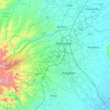
Name: Clark topographic map, elevation, terrain.

Location: Clark, Mabalacat, Pampanga, Central Luzon, 2023, Philippines (15.17094 120.52700 15.21094 120.56700)

Average elevation: 492 ft

Minimum elevation: 354 ft

Maximum elevation: 656 ft

Gear up for your next adventure:

🌡️Portable Weather Meter - Track weather conditions on the trail
🎒Day Hiking Backpack - Lightweight backpack perfect for day trips and outdoor adventures
🔥Plasma Lighters - Windproof lighters that work in any weather condition
🏫Relief Map Kits - Hands-on tools for teaching landforms and elevation
🪶Multi‑Purpose Knife - Useful blade for camp and trail

As an Amazon Associate, this site earns from qualifying purchases at no extra cost to you.