
Thank you for supporting this site ❤️
Make a donation
Make a donation
Gear up for your next adventure:
As an Amazon Associate, this site earns from qualifying purchases at no extra cost to you.
Nanda topographic map
Click on the map to display elevation.
Thank you for supporting this site ❤️
Make a donation
Make a donation
Gear up for your next adventure:
As an Amazon Associate, this site earns from qualifying purchases at no extra cost to you.
About this map
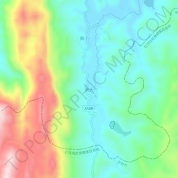
Name: Nanda topographic map, elevation, terrain.
Location: Nanda, Dake, Shilin Yi Autonomous County, Yunnan, China (24.50635 103.20622 24.54635 103.24622)
Average elevation: 6,073 ft
Minimum elevation: 5,600 ft
Maximum elevation: 7,037 ft
Thank you for supporting this site ❤️
Make a donation
Make a donation
Gear up for your next adventure:
As an Amazon Associate, this site earns from qualifying purchases at no extra cost to you.