Geolocate

Manethi topographic map

Click on the map to display elevation.

About this map

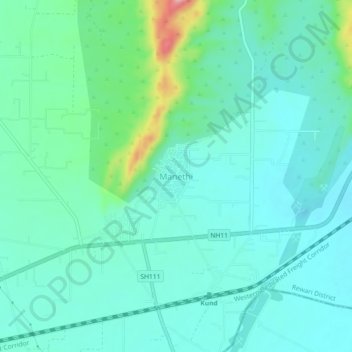
Name: Manethi topographic map, elevation, terrain.

Location: Manethi, Rewari, Rewari District, Haryana, 123103, India (28.13758 76.36901 28.17758 76.40901)

Average elevation: 1,001 ft

Minimum elevation: 896 ft

Maximum elevation: 1,417 ft

Gear up for your next adventure:

🛡️Bear Spray Outdoor - Protection in bear country hikes
🧢Sun Protection Hats - Wide-brimmed and UPF-rated hats for high-altitude sun safety
🥾Women's Hiking Boots - Top-rated trail boots with ankle support and superior grip
🪄Magnetic Compass - Accurate compass for navigation
🧭Outdoor Navigation Book - Learn advanced navigation skills

As an Amazon Associate, this site earns from qualifying purchases at no extra cost to you.