
Thank you for supporting this site ❤️
Make a donation
Make a donation
Gear up for your next adventure:
As an Amazon Associate, this site earns from qualifying purchases at no extra cost to you.
Orden topographic map
Click on the map to display elevation.
Thank you for supporting this site ❤️
Make a donation
Make a donation
Gear up for your next adventure:
As an Amazon Associate, this site earns from qualifying purchases at no extra cost to you.
About this map
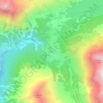
Name: Orden topographic map, elevation, terrain.
Location: Orden, Maloja, Bregaglia, Maloja, Grisons, 7516, Switzerland (46.37368 9.67586 46.41368 9.71586)
Average elevation: 6,522 ft
Minimum elevation: 4,754 ft
Maximum elevation: 9,331 ft
Thank you for supporting this site ❤️
Make a donation
Make a donation
Gear up for your next adventure:
As an Amazon Associate, this site earns from qualifying purchases at no extra cost to you.