Geolocate

binsar topographic map

Click on the map to display elevation.

About this map

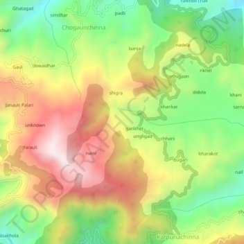
Name: binsar topographic map, elevation, terrain.

Location: binsar, Bāgeshwar, Bageshwar, Uttarakhand, 263642, India (29.75386 79.74531 29.79386 79.78531)

Average elevation: 4,875 ft

Minimum elevation: 3,730 ft

Maximum elevation: 6,152 ft

Gear up for your next adventure:

🪶Camp Gear Gift Set - Perfect gift bundle for outdoor fans
🎒Hydration Pack - Hands‑free water reservoir for long hikes
💧Water Purification System - Clean water on the trail with reliable purifiers
🔦Compact Flashlight - Reliable flashlight for emergencies
🦶Hiking Gaiters - Keep debris and water out of your boots

As an Amazon Associate, this site earns from qualifying purchases at no extra cost to you.