
เอราวัณ topographic map
Interactive map
Click on the map to display elevation.
About this map
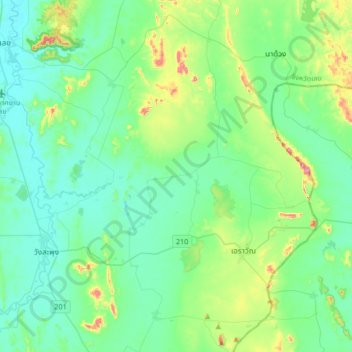
Name: เอราวัณ topographic map, elevation, terrain.
Location: เอราวัณ, Loei (Provinz), Thailand (17.20936 101.73208 17.52936 102.05208)
Average elevation: 1,033 ft
Minimum elevation: 768 ft
Maximum elevation: 2,113 ft
Other topographic maps
Click on a map to view its topography, its elevation and its terrain.
บ้านโนนสะอาด
บ้านโนนสะอาด, ท่าช้างคล้อง, Loei (Provinz), Thailand
Average elevation: 774 ft