Geolocate

Yantalo topographic map

Click on the map to display elevation.

About this map

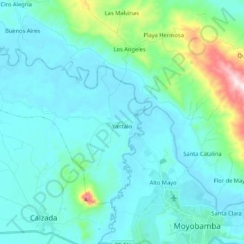
Name: Yantalo topographic map, elevation, terrain.

Location: Yantalo, Province of Moyobamba, San Martín, Peru (-6.02173 -77.14839 -5.92391 -77.00193)

Average elevation: 2,966 ft

Minimum elevation: 2,612 ft

Maximum elevation: 5,161 ft

Gear up for your next adventure:

🪶Camp Gear Gift Set - Perfect gift bundle for outdoor fans
🌡️Portable Weather Meter - Track weather conditions on the trail
🧦Hiking Socks - Comfortable socks to prevent blisters on long hikes
🔦LED Headlamp - Bright and durable LED headlamp for night navigation
🧯Emergency Survival Kit - All‑in‑one survival essentials for the backcountry

As an Amazon Associate, this site earns from qualifying purchases at no extra cost to you.