
Make a donation
Gear up for your next adventure:
As an Amazon Associate, this site earns from qualifying purchases at no extra cost to you.
Salto do Itiquira topographic map
Click on the map to display elevation.
Make a donation
Gear up for your next adventure:
As an Amazon Associate, this site earns from qualifying purchases at no extra cost to you.
About this map
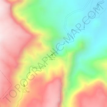
Name: Salto do Itiquira topographic map, elevation, terrain.
Average elevation: 3,028 ft
Minimum elevation: 2,149 ft
Maximum elevation: 3,858 ft
Make a donation
Gear up for your next adventure:
As an Amazon Associate, this site earns from qualifying purchases at no extra cost to you.
Other topographic maps
Click on a map to view its topography, its elevation and its terrain.
Formosinha
Brasil > Goiás > Região Integrada de Desenvolvimento do Distrito Federal e Entorno > Formosa
Average elevation: 3,074 ft
Formosa
Brasil > Goiás > Região Integrada de Desenvolvimento do Distrito Federal e Entorno > Formosa
Average elevation: 3,022 ft
Santa Teresa
Brasil > Goiás > Região Integrada de Desenvolvimento do Distrito Federal e Entorno > Formosa
Average elevation: 2,959 ft