
Thank you for supporting this site ❤️
Make a donation
Make a donation
Gear up for your next adventure:
As an Amazon Associate, this site earns from qualifying purchases at no extra cost to you.
Naugsol topographic map
Click on the map to display elevation.
Thank you for supporting this site ❤️
Make a donation
Make a donation
Gear up for your next adventure:
As an Amazon Associate, this site earns from qualifying purchases at no extra cost to you.
About this map
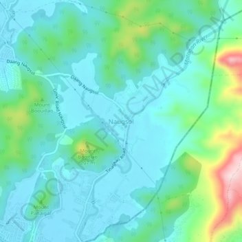
Name: Naugsol topographic map, elevation, terrain.
Location: Naugsol, Subic, Zambales, Central Luzon, 2209, Philippines (14.86000 120.24369 14.90000 120.28369)
Average elevation: 230 ft
Minimum elevation: 16 ft
Maximum elevation: 1,050 ft
Thank you for supporting this site ❤️
Make a donation
Make a donation
Gear up for your next adventure:
As an Amazon Associate, this site earns from qualifying purchases at no extra cost to you.