Geolocate

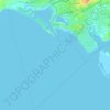
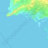
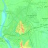
Golarchi topographic map

Click on the map to display elevation.

About this map

Name: Golarchi topographic map, elevation, terrain.

Location: Golarchi, Badin, Sindh, 72200, Pakistan (24.61037 68.49327 24.69037 68.57327)

Average elevation: 30 ft

Minimum elevation: 20 ft

Maximum elevation: 36 ft

Other topographic maps

Click on a map to view its topography, its elevation and its terrain.
Orangi Town

Pakistan > Sindh > Karachi Division

Average elevation: 207 ft

Sindhri Taluka

Pakistan > Sindh > Mirpur Khas District

Average elevation: 52 ft

Keamari Town

Pakistan > Sindh > Karachi Division

Average elevation: 7 ft

Malir Town

Pakistan > Sindh > Karachi Division

Average elevation: 85 ft

Sukkur District

Pakistan > Sindh

Average elevation: 210 ft

Urban Forest

Pakistan > Sindh > Karachi Division > Saddar Town

Average elevation: 30 ft

Jamshed Town

Pakistan > Sindh > Karachi Division

Average elevation: 66 ft

Mominabad Town

Pakistan > Sindh > Karachi Division

Average elevation: 194 ft

Mauripur Town

Pakistan > Sindh > Karachi Division

Average elevation: 33 ft

Kokan Family Park

Pakistan > Sindh > Gulshan Town

Average elevation: 108 ft

Kidney Hill Park

Pakistan > Sindh > Gulshan Town > Al Hamra

Average elevation: 112 ft

Hyderabad

Pakistan > Sindh

Average elevation: 69 ft

Gear up for your next adventure:

☕Camping Coffee Makers - Enjoy premium coffee at the summit or campsite
📚USA Hiking Guide Books - Top trail guides and map books
🪑Portable Camp Table - Compact table for campsite meals
🔦Compact Flashlight - Reliable flashlight for emergencies
🪶Camp Gear Gift Set - Perfect gift bundle for outdoor fans

As an Amazon Associate, this site earns from qualifying purchases at no extra cost to you.