Geolocate

Nadrin topographic map

Click on the map to display elevation.

About this map

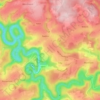
Name: Nadrin topographic map, elevation, terrain.

Location: Nadrin, Houffalize, Bastogne, Luxembourg, Wallonia, Belgium (50.12476 5.65189 50.18113 5.70825)

Average elevation: 1,250 ft

Minimum elevation: 781 ft

Maximum elevation: 1,572 ft

Gear up for your next adventure:

🥾Men's Hiking Boots - Durable, waterproof footwear for rugged terrain and steep inclines
🌐World Map Poster - Decorative world maps with topographic info
🛠️Backpacking Tool Kit - Essential toolkit for outdoor repairs
🔥Fast-Boil Camping Stoves - Efficient cooking systems for quick trail meals
👓Polarized Sunglasses - Outdoor sunglasses for glare reduction

As an Amazon Associate, this site earns from qualifying purchases at no extra cost to you.