
Thank you for supporting this site ❤️
Make a donation
Make a donation
Gear up for your next adventure:
As an Amazon Associate, this site earns from qualifying purchases at no extra cost to you.
kasei topographic map
Click on the map to display elevation.
Thank you for supporting this site ❤️
Make a donation
Make a donation
Gear up for your next adventure:
As an Amazon Associate, this site earns from qualifying purchases at no extra cost to you.
About this map
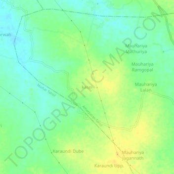
Name: kasei topographic map, elevation, terrain.
Location: kasei, Amarpatan Tahsil, Satna, Madhya Pradesh, India (24.32302 80.90384 24.36302 80.94384)
Average elevation: 1,099 ft
Minimum elevation: 1,060 ft
Maximum elevation: 1,142 ft
Thank you for supporting this site ❤️
Make a donation
Make a donation
Gear up for your next adventure:
As an Amazon Associate, this site earns from qualifying purchases at no extra cost to you.