
Thank you for supporting this site ❤️
Make a donation
Make a donation
Gear up for your next adventure:
As an Amazon Associate, this site earns from qualifying purchases at no extra cost to you.
Rodeiro topographic map
Click on the map to display elevation.
Thank you for supporting this site ❤️
Make a donation
Make a donation
Gear up for your next adventure:
As an Amazon Associate, this site earns from qualifying purchases at no extra cost to you.
About this map
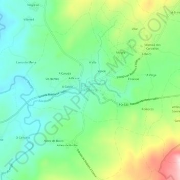
Name: Rodeiro topographic map, elevation, terrain.
Location: Rodeiro, Deza, Pontevedra, Galicia, 36530, España (42.62904 -7.96817 42.66904 -7.92817)
Average elevation: 2,247 ft
Minimum elevation: 1,923 ft
Maximum elevation: 2,920 ft
Thank you for supporting this site ❤️
Make a donation
Make a donation
Gear up for your next adventure:
As an Amazon Associate, this site earns from qualifying purchases at no extra cost to you.