Geolocate

Avacelli topographic map

Click on the map to display elevation.

About this map

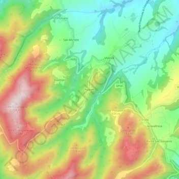
Name: Avacelli topographic map, elevation, terrain.

Location: Avacelli, Arcevia, Ancona, Marche, Italia (43.45075 12.96367 43.49075 13.00367)

Average elevation: 1,414 ft

Minimum elevation: 755 ft

Maximum elevation: 2,293 ft

Gear up for your next adventure:

🪶Thermal Camp Blanket - Extra warmth for cold nights
🧭Pro Hiking Compasses - High-accuracy liquid-filled compasses for topographic orientation
🏕️Tent Footprint - Protect your tent base from wear
🏥Hiking First Aid Kits - Comprehensive medical kits for remote trail injuries
🌐World Map Poster - Decorative world maps with topographic info

As an Amazon Associate, this site earns from qualifying purchases at no extra cost to you.