
Thank you for supporting this site ❤️
Make a donation
Make a donation
Gear up for your next adventure:
As an Amazon Associate, this site earns from qualifying purchases at no extra cost to you.
Nazaria topographic map
Click on the map to display elevation.
Thank you for supporting this site ❤️
Make a donation
Make a donation
Gear up for your next adventure:
As an Amazon Associate, this site earns from qualifying purchases at no extra cost to you.
About this map
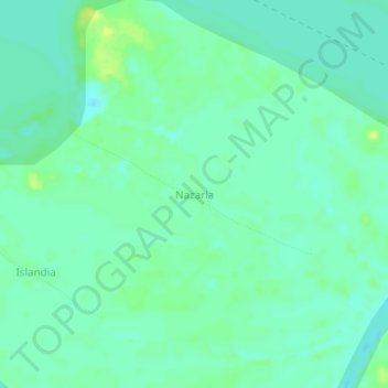
Name: Nazaria topographic map, elevation, terrain.
Location: Nazaria, Las Amazonas, Maynas, Loreto, Peru (-3.53166 -72.51687 -3.49166 -72.47687)
Average elevation: 256 ft
Minimum elevation: 236 ft
Maximum elevation: 289 ft
Thank you for supporting this site ❤️
Make a donation
Make a donation
Gear up for your next adventure:
As an Amazon Associate, this site earns from qualifying purchases at no extra cost to you.