
Portula topographic map
Click on the map to display elevation.
About this map
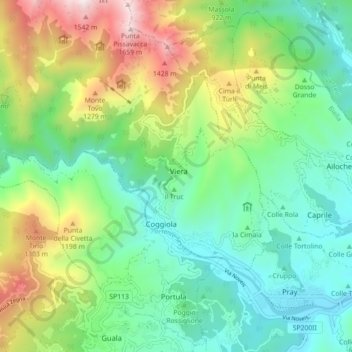
Name: Portula topographic map, elevation, terrain.
Location: Portula, Biella, Piedmont, 13833, Italy (45.66660 8.10228 45.72654 8.19119)
Average elevation: 2,657 ft
Minimum elevation: 1,309 ft
Maximum elevation: 5,531 ft
Other topographic maps
Click on a map to view its topography, its elevation and its terrain.