Pitomine topographic map
Interactive map
Click on the map to display elevation.
About this map

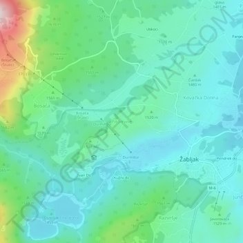
Name: Pitomine topographic map, elevation, terrain.
Location: Pitomine, Žabljak Municipality, 84220, Montenegro (43.14113 19.08561 43.18113 19.12561)
Average elevation: 4,944 ft
Minimum elevation: 4,596 ft
Maximum elevation: 6,240 ft
Other topographic maps
Click on a map to view its topography, its elevation and its terrain.

Žabljak
Montenegro > Žabljak Municipality
Žabljak is the seat of Žabljak Municipality (2011 population: 3,569). The town is in the centre of the Durmitor mountain region and with an altitude of 1,456 metres, it is the highest situated Balkan town.
Average elevation: 4,793 ft