
Burr Ridge topographic map
Click on the map to display elevation.
About this map
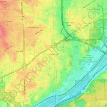
Name: Burr Ridge topographic map, elevation, terrain.
Location: Burr Ridge, DuPage County, Illinois, 65027, United States (41.71228 -87.94522 41.78957 -87.89267)
Average elevation: 686 ft
Minimum elevation: 581 ft
Maximum elevation: 794 ft
DuPage County trails, hiking, mountain biking, running and outdoor activities
Other topographic maps
Click on a map to view its topography, its elevation and its terrain.
Downers Grove
United States > Illinois > DuPage County > Downers Grove > Downers Grove
Average elevation: 745 ft