
Thank you for supporting this site ❤️
Make a donation
Make a donation
Gear up for your next adventure:
As an Amazon Associate, this site earns from qualifying purchases at no extra cost to you.
Runa topographic map
Click on the map to display elevation.
Thank you for supporting this site ❤️
Make a donation
Make a donation
Gear up for your next adventure:
As an Amazon Associate, this site earns from qualifying purchases at no extra cost to you.
About this map
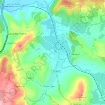
Name: Runa topographic map, elevation, terrain.
Location: Runa, Dois Portos e Runa, Torres Vedras, Lisbon, Portugal (39.05103 -9.22918 39.08474 -9.18971)
Average elevation: 344 ft
Minimum elevation: 138 ft
Maximum elevation: 761 ft
Thank you for supporting this site ❤️
Make a donation
Make a donation
Gear up for your next adventure:
As an Amazon Associate, this site earns from qualifying purchases at no extra cost to you.