
Thank you for supporting this site ❤️
Make a donation
Make a donation
Gear up for your next adventure:
As an Amazon Associate, this site earns from qualifying purchases at no extra cost to you.
Jökulheimar topographic map
Click on the map to display elevation.
Thank you for supporting this site ❤️
Make a donation
Make a donation
Gear up for your next adventure:
As an Amazon Associate, this site earns from qualifying purchases at no extra cost to you.
About this map
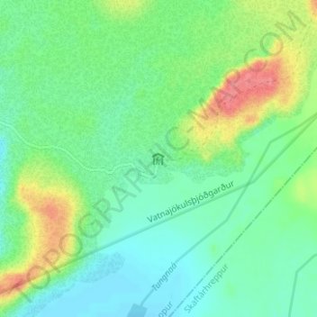
Name: Jökulheimar topographic map, elevation, terrain.
Location: Jökulheimar, Ásahreppur, Southern Region, Iceland (64.30026 -18.24850 64.32026 -18.22850)
Average elevation: 2,228 ft
Minimum elevation: 2,149 ft
Maximum elevation: 2,408 ft
Thank you for supporting this site ❤️
Make a donation
Make a donation
Gear up for your next adventure:
As an Amazon Associate, this site earns from qualifying purchases at no extra cost to you.