
Make a donation
Gear up for your next adventure:
As an Amazon Associate, this site earns from qualifying purchases at no extra cost to you.
Vermont topographic map
Click on the map to display elevation.
Make a donation
Gear up for your next adventure:
As an Amazon Associate, this site earns from qualifying purchases at no extra cost to you.
About this map
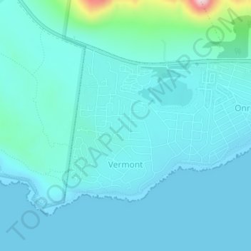
Name: Vermont topographic map, elevation, terrain.
Average elevation: 121 ft
Minimum elevation: 0 ft
Maximum elevation: 1,040 ft
Make a donation
Gear up for your next adventure:
As an Amazon Associate, this site earns from qualifying purchases at no extra cost to you.
Other topographic maps
Click on a map to view its topography, its elevation and its terrain.
Pringle Bay Peak
South Africa > Western Cape > Overberg District Municipality > Overstrand Local Municipality
Average elevation: 115 ft
Danger Point Lighthouse
South Africa > Western Cape > Overberg District Municipality > Overstrand Local Municipality
Average elevation: 20 ft
Kleinbaai
South Africa > Western Cape > Overberg District Municipality > Overstrand Local Municipality
Average elevation: 49 ft