
Thank you for supporting this site ❤️
Make a donation
Make a donation
Gear up for your next adventure:
As an Amazon Associate, this site earns from qualifying purchases at no extra cost to you.
Dheerpura topographic map
Click on the map to display elevation.
Thank you for supporting this site ❤️
Make a donation
Make a donation
Gear up for your next adventure:
As an Amazon Associate, this site earns from qualifying purchases at no extra cost to you.
About this map
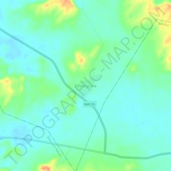
Name: Dheerpura topographic map, elevation, terrain.
Location: Dheerpura, Balesar Tehsil, Jodhpur District, Rajasthan, India (26.42975 72.41402 26.46975 72.45402)
Average elevation: 906 ft
Minimum elevation: 863 ft
Maximum elevation: 1,020 ft
Thank you for supporting this site ❤️
Make a donation
Make a donation
Gear up for your next adventure:
As an Amazon Associate, this site earns from qualifying purchases at no extra cost to you.