Geolocate

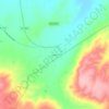
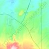
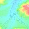
Eagar topographic map

Click on the map to display elevation.

About this map

Name: Eagar topographic map, elevation, terrain.

Location: Eagar, Apache County, Arizona, 85925, United States (34.08253 -109.34972 34.12909 -109.23158)

Average elevation: 7,306 ft

Minimum elevation: 6,906 ft

Maximum elevation: 8,533 ft

Apache County trails, hiking, mountain biking, running and outdoor activities

Other topographic maps

Click on a map to view its topography, its elevation and its terrain.
Greer

United States > Arizona > Apache County

Average elevation: 8,757 ft

East Mesa

United States > Arizona > Apache County

Average elevation: 6,867 ft

Sanders

United States > Arizona > Apache County

Average elevation: 5,909 ft

Fort Defiance

United States > Arizona > Apache County

Average elevation: 6,988 ft

Ganado

United States > Arizona > Apache County > Ganado

Average elevation: 6,522 ft

Spider Rock

United States > Arizona > Apache County

Average elevation: 6,411 ft

Concho

United States > Arizona > Apache County

Average elevation: 6,050 ft

Lupton

United States > Arizona > Apache County

Average elevation: 6,371 ft

Chambers

United States > Arizona > Apache County

Average elevation: 5,827 ft

Vernon

United States > Arizona > Apache County

Average elevation: 6,952 ft

Many Farms

United States > Arizona > Apache County

Average elevation: 5,384 ft

Red Hill

United States > Arizona > Apache County

Average elevation: 6,004 ft

Red Rock

United States > Arizona > Apache County

Average elevation: 5,840 ft

Black Knoll

United States > Arizona > Apache County

Average elevation: 5,728 ft

Teec Nos Pos

United States > Arizona > Apache County

Average elevation: 5,315 ft

Fly Spring

United States > Arizona > Apache County

Average elevation: 8,858 ft

Red Rock

United States > Arizona > Apache County

Average elevation: 5,840 ft

Chinle

United States > Arizona > Apache County > Chinle

Average elevation: 5,627 ft

Concho

United States > Arizona > Apache County > Concho

Average elevation: 6,050 ft

Lukachukai

United States > Arizona > Apache County

Average elevation: 6,575 ft

Sawmill

United States > Arizona > Apache County

Average elevation: 7,723 ft

Concho

United States > Arizona > Apache County

Average elevation: 6,050 ft

Vernon

United States > Arizona > Apache County

Average elevation: 6,952 ft

Nutrioso

United States > Arizona > Apache County

Average elevation: 7,887 ft

Red Rock

United States > Arizona > Apache County

Average elevation: 5,840 ft

Michigan Lake

United States > Arizona > Apache County

Average elevation: 6,194 ft

Toyei

United States > Arizona > Apache County

Average elevation: 6,539 ft

St. Michaels

United States > Arizona > Apache County

Average elevation: 6,778 ft

Gear up for your next adventure:

🧥Men's Rain Shells - Premium waterproof and breathable jackets for mountain weather
🔋Solar Power Banks - Keep your GPS and phone charged in remote wilderness areas
🔭Compact Binoculars - HD vision for scouting terrain and identifying distant landmarks
🛌Ultralight Sleeping Bags - Compact down bags for cold nights in the wilderness
🪶Thermal Camp Blanket - Extra warmth for cold nights

As an Amazon Associate, this site earns from qualifying purchases at no extra cost to you.