Geolocate

Balbeggie topographic map

Click on the map to display elevation.

About this map

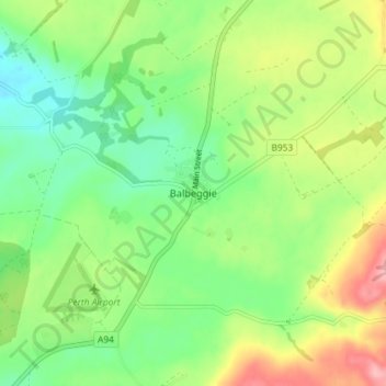
Name: Balbeggie topographic map, elevation, terrain.

Location: Balbeggie, Perth and Kinross, Scotland, PH2 6HA, United Kingdom (56.42968 -3.36923 56.46968 -3.32923)

Average elevation: 390 ft

Minimum elevation: 230 ft

Maximum elevation: 653 ft

Other topographic maps

Click on a map to view its topography, its elevation and its terrain.

Gear up for your next adventure:

🧢Sun Protection Hats - Wide-brimmed and UPF-rated hats for high-altitude sun safety
🎒Waterproof Dry Bags - Keep your electronics and maps dry inside your pack
🧦Merino Wool Socks - Moisture-wicking, blister-preventing socks for long treks
🔭Telescopic Hiking Pole - Adjustable pole for hiking stability
🎒Hydration Pack - Hands‑free water reservoir for long hikes

As an Amazon Associate, this site earns from qualifying purchases at no extra cost to you.