
Thank you for supporting this site ❤️
Make a donation
Make a donation
Gear up for your next adventure:
As an Amazon Associate, this site earns from qualifying purchases at no extra cost to you.
Bolo topographic map
Click on the map to display elevation.
Thank you for supporting this site ❤️
Make a donation
Make a donation
Gear up for your next adventure:
As an Amazon Associate, this site earns from qualifying purchases at no extra cost to you.
About this map
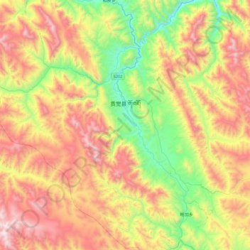
Name: Bolo topographic map, elevation, terrain.
Location: Bolo, Gonjo County, Chamdo City, Tibet, 854200, China (30.65495 97.99942 31.00208 98.43763)
Average elevation: 13,914 ft
Minimum elevation: 11,444 ft
Maximum elevation: 16,959 ft
Thank you for supporting this site ❤️
Make a donation
Make a donation
Gear up for your next adventure:
As an Amazon Associate, this site earns from qualifying purchases at no extra cost to you.