
Davison topographic map
Click on the map to display elevation.
About this map
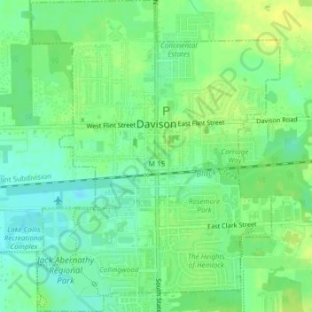
Name: Davison topographic map, elevation, terrain.
Location: Davison, Genesee County, Michigan, 48423, United States (43.01825 -83.53309 43.04555 -83.50322)
Average elevation: 797 ft
Minimum elevation: 764 ft
Maximum elevation: 823 ft
Genesee County trails, hiking, mountain biking, running and outdoor activities
Other topographic maps
Click on a map to view its topography, its elevation and its terrain.
Genessee County Recreational Area
United States > Michigan > Genesee County > Genesee Charter Township
Average elevation: 758 ft